| Prod Model: |
V90Plus |
| Markets: |
South America,Mid East,Eastern Asia,Western Europe |
| Tracking Channel: |
220 |
| IP: |
67 |
Product Description
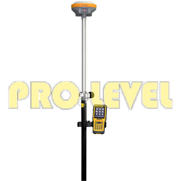
V90PLUS GNSS RTK SYSTEM
With a hi-tech, fully integrated design, the conveniently sized V90Plus is one of the most flexible choices for any measuring task. Built-in Linux3.2.0 operating system, pre-loaded multiple smart applications such as tilt surveying, electronic bubble calibration, NFC and voice DIY, V90Plus GNSS system provides surveyor industry-leading GNSS solutions.
Small and lightweight
·Only weighs 950g.
·Measures Diameter 153mm x Height 83mm.
Multi-constellation Tracking
·220 tracking channels
·Supports GPS, GLONASS, GALILEO, BDS, SBAS
·NGS approved full-band GNSS antenna
Smart Application
·Offers tilt survey with a maximum tilt angle of 30 degrees.
·Supports electronic bubble calibration
·The internal NFC module makes Bluetooth communication quick and easy.
·Intelligent voice assistance guides field operations. Voice can be DIY.
·Standard Rinex data and HI-TARGET raw data recorded simultaneously.
Optional Transceiver UHF Radio
·The transceiver UHF radio enables switchable working modes between base and rover.
·Three types of internal UHF radio provide different frequencies based on users requirements. The Pacific Crest TrimTalk© internal UHF radio is compatible with other radios.
Multi-network Connection
·Supports GPRS, GSM and WCDMA
·Supports WIFI
Powerful Battery
·Powered by high-capacity (5000mAh) Li-ion battery to ensure full day operation
Rugged Design
·IP67 dustproof and waterproof
·Able to survive a 3-meter natural fall onto concrete
Satellite Signals Tracked Simultaneously
* 220 Channels
* GPS..... Simultaneous L1C/A, L2C, L2E, L5
* GLONASS........Simultaneous L1C/A, L1P, L2C/A (GLONASS M only), L2P
* SBAS............. Simultaneous L1 C/A, L5
* Galileo............ Simultaneous L1 BOC, E5A, E5B, E5AltBOC
* BDS............................... B1, B2
* QZSS.............. L1 C/A, L1 SAIF, L2C, L5
POSITIONING PERFORMANCE
Static and Fast Static GNSS Surveying
* Horizontal............2.5mm+0.5ppm RMS
* Vertical................ 5mm+0.5ppm RMS
Post Processing Kinematic (PPK / Stop & Go) GNSS Surveying
* Horizontal.............. 1cm+1ppm RMS
* Vertical............... 2.5cm+1ppm RMS
* Initialization time....Typically 10 minutes for base while 5 minutes for rover
* Initialization reliability...Typically > 99.9%
Real Time Kinematic (RTK) Surveying
Single Baseline
* Horizontal.............. 8mm+1ppm RMS
* Vertical................ 15mm+1ppm RMS
Network RTK
* Horizontal.............. 8mm+0.5ppm RMS
* Vertical................. 15mm+0.5ppm RMS
* Initialization time.....Typically < 8seconds
* Initialization reliability....Typically > 99.9%
Code Differential GNSS Positioning
* Horizontal............. 25cm+1ppm RMS
* Vertical............... 50cm+1ppm RMS
* SBAS ... 0.50m Horizontal, 0.85m Vertical
HARDWARE
Physical
* Dimensions (W x H)....153mm x 83mm (6.02inch x 3.27inch)
* Weight...950g (2.09lb) without internal battery
* Operating temperature.... -40ºCto +65ºC (-40ºF to +149ºF)
* Storage temperature....... -40ºC to +75ºC(-40ºF to +167ºF)
* Humidity............. 100%, considering
* Water/dustproof........... IP67 dustproof, protected from temporary immersion to depth of 1m (3.28ft).
* Shock and vibration......Designed to survive a 3m(9.84ft) natural fall onto concrete.
Electrical
* Power 6V to 28V DC external power input
* Power consumption ≤3.5W
* Automatic switching between internal power and external power
* Rechargeable, removable 7.4V, 5000mAh Lithium-ion battery in internal battery compartment
Internal Battery Life
* Static 12hours
* RTK rover (UHF/GPRS/3G) 8-10 hours
* RTK base 8 hours
I/O Interface
* 1 xBluetooth, NFC
* 1 x standard USB2.0 port
* 1 x TNC antenna connector
* 1 x RS232 serial port
* 1 x DC power input (5-pin)
Tilt Survey System
Electronic Bubble
COMMUNICATION
Network Communication
* Fully integrated, fully sealed internal WCDMA, compatible with GPRS, GSM
* Wifi frequency is 2.4G, supports 802.11b/g/n protocol
* Network RTK (via CORS) range20-50km
HI-TARGET Internal UHF Radio(Standard)
* Frequency 450~470MHz with 116 channels
* Transmitting power0.5W, 1W, 2W adjustable
* Transmitting speed....9.6Kbps, 19.2Kbps
* Working range.......3~5km typical, 8~10kmoptimal
Pacific Crest XDL Micro Internal UHF Radio
* Frequency................403~473MHz
* Transmitting power......... 0.5W, 2W adjustable
* Transmitting speed........ Up to 19.2Kbps
* Support most of radio communication protocol
* Working range............ 3~5km typical, 8~10km optimal
HI-TARGET External UHF Radio (Standard)
* Frequency...... 460MHz with 116 channels
* Transmitting power.... 5W, 10W, 20W, 30W adjustable
* Transmitting speed...... Up to 19.2Kbps
* Working range.......... 8~10km typical, 15~20km optimal
Pacific Crest ADL Vantage Pro External UHF Radio
* Frequency. 390~430MHz or 430~470MHz
* Transmitting power.. 4W to 35W adjustable
* Transmitting speed........ Up to 19.2Kbps
* Support most of radio communication protocol
* Working range. 8~10km typical, 15~20km optimal
SYSTEM CONFIGURATION
System
* Data storage.........16GB Internal storage (Support up to 32GB external SD card)
* Record GNS and RINEX format simultaneously
Data Formats
* 1Hz positioning output, up to 20Hz
* CMR: CMR, CMR+, sCMRx input and output
* RTCM: RTCM 2.1, 2.3, 3.0, 3.1, 3.2 input and output
* Navigation outputs ASCII: NMEA-0183 GSV, AVR, RMC, HDT, VGK, VHD, ROT, GGK, GGA, GSA, ZDA, VTG, GST, PJT, PJK, BPQ, GLL, GRS, GBS
* Navigation outputs binary: GSOF
Changzhou Skyvictor Import and Export Co., Ltd is one of the professional China exporter for all kinds of the construction lasers and the surveying instruments.
Our product range covers the rotary laser level, the multi-line laser level, the laser distance meter, the theodolite, the total station, etc. The most competitive price, the good product quality as well as the good customer service help us to build up the good company image in the international market.
With many years exporting experiences for the construction laser products, we win the trust from many customers overseas. To achieve win-win situation is always the final business goal we share with each customer.
We are sincerely looking forward to establishing long-term business partner relationship with you!